 Venue: Bindoora Estate, Ulu Yam
Travel Time: 90 minutes
Date: Sunday 10th April, 2016
Run Starts at: 15:00 – Be there for 14:45
Hare: Amber Freer
Co-Hare(s): Robert Scourse
Celebration Run
Our next run will be a special Easter Run on 10 APRIL 2016 at Bindoora Estate (directions will be posted soon). This will be a celebration run so be prepared for some egg-citing fun and games. OnOn!
Directions:
Option #1: SCENIC ROUTE VIA BATU CAVES (Fastest)
– Get either onto Jalan Kuching North from KL, and take the 3 o’clock exit Batu at the Batu Caves/Kepong Roundabout, OR, Get onto the MRR2 from Sungai Buloh, etc. and head towards Batu Caves. Trip meter at Roundabout.
– km 0.5 Exit left on the first exit after leaving the roundabout,
– km 1.2 turn left again, and get into right hand lane.
– km 1.9 Turn right at the traffic lights with the Mosque on your right and head through Selayang town,
– km 6.0 Go past the Petronas on the left and then
– km 6.5 Turn right onto old reservoir road (B57), following signs to Ulu Yam.
– Proceed about 21km until you come to a bridge and a T-junction
– after crossing bridge, turn LEFT at T-junction
– go slowly into Ulu Yam town, turn RIGHT after 7-11, signposted towards “Genting Highlands” (B113)
– after about 500 meters, pass Police Station on left.
– immediately look for right turn before the bridge, turn RIGHT at sign “Amber Stone Resort”
– drive about 1.5km slowly through Kampung (many children, dogs, frogs, chickens etc playing)
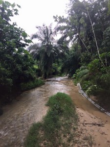
– Look for left turn to Bundoora Sdn Bhd. TURN LEFT. Cross bridge, enter Bindoora Ranch, Keep Right, follow signs to parking after the Ranch in the Oil Palm, near a hot spring.
OPTION #2: VIA NKVE HIGHWAY AND RAWANG
– Take the NKVE north to Rawang and exit junction 116.
– TURN RIGHT and zero trip meter at traffic lights just after Rawang toll
– Go towards Rawang, then straight across bridge on bypass to Serendah/Batang Kali and onto the old road to Batang Kali/Ipoh.
– Keep driving. On the way from the toll you should pass the following land marks:
– 3.8km roundabout on the Rawang by pass, 5.2km Petronas Service Station on your right.
– 7.3km Petronas Service Station on your left, 10.0km BP Service Station on your left.
– 10.4km Shell Service Station on your right, 12.1km Petronas Service Station on your right
– 13.6km Big Golf ball on your right (Serendah golf course),
– 23.0km Petronas Service Station on your left just after the bridge in Batang Kali
– 23.4km TURN RIGHT at traffic lights route B66 towards “Ulu Yam Baru/Genting Highlands”
– Reset trip meter to zero at traffic lights! Then:
– At 1.5km Petronas Service Station on your left,
– 1.9km digital traffic lights Go Straight.
– Drive another 1.8 km past Yat Lott Fatt Fatt Restaurant.
– Straight across the turn to Genting Highlands.
– Drive another 2 km and look for Left Turn to Amberstone Resort. If you pass Ulu Yam Bharu Police Station you have gone too far.
– Drive approx 1.6 km slowly through Kampong, (many children, dogs, frogs, wogs, hogs, logs, chickens etc playing). Look for Bundoora Sdn Bhd Sign.
– Turn Left to Bundoora Sdn Bhd. Cross bridge, enter Bundoora Ranch, Keep Right, follow signs to parking after the Ranch in the Oil Palmirecetiste
– Get either onto Jalan Kuching North from KL, and take the 3 o’clock exit Batu at the Batu Caves/Kepong Roundabout, OR, Get onto the MRR2 from Sungai Buloh, etc. and head towards Batu Caves. Trip meter at Roundabout.
– km 0.5 Exit left on the first exit after leaving the roundabout,
– km 1.2 turn left again, and get into right hand lane.
– km 1.9 Turn right at the traffic lights with the Mosque on your right and head through Selayang town,
– km 6.0 Go past the Petronas on the left and then
– km 6.5 Turn right onto old reservoir road (B57), following signs to Ulu Yam.
– Proceed about 21km until you come to a bridge and a T-junction
– after crossing bridge, turn LEFT at T-junction
– go slowly into Ulu Yam town, turn RIGHT after 7-11, signposted towards “Genting Highlands” (B113)
– after about 500 meters, pass Police Station on left.
– immediately look for right turn before the bridge, turn RIGHT at sign “Amber Stone Resort”
– drive about 1.5km slowly through Kampung (many children, dogs, frogs, chickens etc playing)
– Look for left turn to Bundoora Sdn Bhd. TURN LEFT. Cross bridge, enter Bindoora Ranch, Keep Right, follow signs to parking after the Ranch in the Oil Palm, near a hot spring.
OPTION #2: VIA NKVE HIGHWAY AND RAWANG
– Take the NKVE north to Rawang and exit junction 116.
– TURN RIGHT and zero trip meter at traffic lights just after Rawang toll
– Go towards Rawang, then straight across bridge on bypass to Serendah/Batang Kali and onto the old road to Batang Kali/Ipoh.
– Keep driving. On the way from the toll you should pass the following land marks:
– 3.8km roundabout on the Rawang by pass, 5.2km Petronas Service Station on your right.
– 7.3km Petronas Service Station on your left, 10.0km BP Service Station on your left.
– 10.4km Shell Service Station on your right, 12.1km Petronas Service Station on your right
– 13.6km Big Golf ball on your right (Serendah golf course),
– 23.0km Petronas Service Station on your left just after the bridge in Batang Kali
– 23.4km TURN RIGHT at traffic lights route B66 towards “Ulu Yam Baru/Genting Highlands”
– Reset trip meter to zero at traffic lights! Then:
– At 1.5km Petronas Service Station on your left,
– 1.9km digital traffic lights Go Straight.
– Drive another 1.8 km past Yat Lott Fatt Fatt Restaurant.
– Straight across the turn to Genting Highlands.
– Drive another 2 km and look for Left Turn to Amberstone Resort. If you pass Ulu Yam Bharu Police Station you have gone too far.
– Drive approx 1.6 km slowly through Kampong, (many children, dogs, frogs, wogs, hogs, logs, chickens etc playing). Look for Bundoora Sdn Bhd Sign.
– Turn Left to Bundoora Sdn Bhd. Cross bridge, enter Bundoora Ranch, Keep Right, follow signs to parking after the Ranch in the Oil Palmirecetiste
Can you please advise GPS coordinates for this run?
Approximately here. Dropped Pin
near Lorong Kiambang, 48200 Batang Kali, Selangor
https://goo.gl/maps/caZRmzpxpyD2
At this point you go on to unpacked road but there will be signs. Sorry I can’t get GPS coordinates using an iPad 🙁